About the FAKTS Database
Introduction to the Fluvial Architecture Knowledge Transfer System (FAKTS): a database of fluvial-reservoir analogues
The Fluvial Architecture Knowledge Transfer System (FAKTS) is a
research-led flagship initiative of the Fluvial Research Group (FRG) at
the University of Leeds. FAKTS is a relational database storing hard and
soft data about fluvial sedimentary architecture that has been
populated with data derived from both original FRG fieldwork studies and
peer-reviewed literature syntheses. The database incorporates
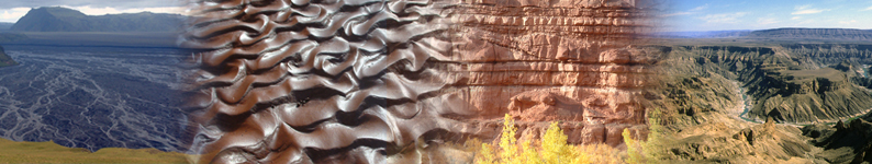
information from both modern rivers and ancient successions that have
been selected because they are considered to represent potential
analogues to hydrocarbon reservoirs hosted in fluvial rocks.
FAKTS comprises a database system that is recognized as the most
sophisticated repository yet developed for the storage and structured
retrieval of quantitative information relating to fluvial sedimentary
architecture. The FAKTS database is available in its full form
exclusively to FRG group sponsors
Click here
to learn more and find out how FAKTS can be applied to resolve issues
related to subsurface reservoir prediction and characterization.
International recognition for FAKTS
An elaborate new database system from which to sample input
parameters relating to depositional systems, architectural elements and
lithofacies in order to construct reservoir models for development
engineering purposes. This approach appears to be by far the most
sophisticated in this category of model building. Quote from Andrew
Miall in his new book Fluvial Depositional Systems, Springer, p. 4-5,
relating to Colombera et al. (2012).
FAKTS on Ava Clastics
To enhance sponsor impact, the FRG has collaborated with external
partner Petrotechnical Data Systems (PDS) to develop a product that enables direct coupling of FAKTS
with modelling workflows: Ava Clastics
How
does the version of FAKTS available as part of membership of FRG-ERG
differ to the version of FAKTS available via Ava Clastics? Click here to compare.
How does FAKTS work?
The FAKTS database is employed as a system for the digital
reproduction of all the essential features of fluvial sedimentary
architecture; it accounts for the style of internal organization of
fluvial bodies, their geometries, grain size, spatial distribution, and
the hierarchical and spatial reciprocal relationships of genetic units
that comprise these geological bodies. FAKTS additionally classifies
depositional systems or parts thereof according to both controlling
factors (e.g. climate type, tectonic setting), and context-descriptive
characteristics (e.g. channel/river pattern, dominant transport
mechanism).
The FAKTS database can be interrogated either through a menu-driven
online front-end hosted on the FRG web site, or by performing SQL
queries on a downloadable version of the database in such a way that
highly customized results can be obtained. The database output consists
of user-defined sets of quantitative information on particular
characters of sedimentary architecture, as derived form a suite of
analogues, whose analogy to a particular reservoir is considered in
terms of architectural properties and/or depositional-system parameters.
FAKTS output can be applied to fluvial-reservoir characterization and
prediction. The database serves as a tool with which to achieve the
following primary goals:
- guide well correlation of fluvial sandstones;
- condition object- and pixel-based stochastic reservoir models;
- predict the likely heterogeneity of geophysically-imaged geobodies;
- inform interpretation of lithologies observed in core.
How can FAKTS be applied to subsurface characterization problems?
- Build quantitative facies models that describe the distribution
of architectural elements within channelized and floodplain settings;
characterize the scale, orientation and stacking of these elements and
their style of juxtaposition relative to one another.
- Build models that describe the likely internal facies
arrangements present in individual architectural elements; determine the
relative proportions of facies that make up certain elements and
predict their vertical, cross-stream and downstream transitions.
- Predict the expected dimensions of architectural elements away
from the borehole; predict the most likely arrangement of neighbouring
elements.
- Filter the output from the database such that only those data from
fluvial systems that meet the specified search criteria are returned.
- Compare differences in sedimentary architecture for different
types of fluvial system and controlling conditions: for example, compare
differences in scale and connectivity of sand bodies in braided versus
single-thread (meandering) rivers, or rivers developed in semi-arid
versus sub-humid climatic settings, or pre-vegetation (i.e.
pre-Silurian) fluvial successions versus post-vegetation successions, or
fluvial successions preserved in rift basin settings versus those
preserved in foreland basin settings.
- Compile exhaustive comparative statistics for different types of
fluvial system: for example, calculate channel-complex proportion,
channel-complex thickness and width and channel-complex connectivity for
different fluvial types.
- Observe how the proportions of facies or architectural elements
(and their transition probabilities) change as progressively more
filters are included in a query: for example, compare a generic fluvial
system, to a braided system, to a braided system developed in a
semi-arid climate, to an ephemeral braided system.
- Plot width-thickness relationships for any element (not just
channels) and include filters to observe how such relationships vary
between different fluvial system types.
- Undertake a full analysis of lithofacies composition for any
architectural element type (and filter by fluvial system type, climate,
basin setting, geological age, palaeolatitude etc).
- Make statistical comparisons between published case studies and compare with well-data from your own reservoirs.
- Make statistical comparisons between modern systems and their
ancient preserved successions; check the validity (or otherwise!) of
your preferred modern system as an analogue for your subsurface
reservoir succession.
FAKTS key features
The genetic units included in FAKTS are equally recognizable in both
the stratigraphic and geomorphic realms, and belong to three
hierarchies of observation: depositional elements, architectural
elements and facies units, in order of descending scale.
- The geometries of the genetic units are characterized by
dimensional parameters describing their extent in the vertical,
strike-lateral and downstream directions, relative to the
channel-belt-scale flow direction (thickness, width and length);
geometrical parameters are classified on type of observation (i.e. real,
apparent, partial, or unlimited).
- The reciprocal relations among genetic units are stored by
recording and tracking (i) the containment of each unit within its
higher scale parent unit (e.g. facies units within architectural
elements), and (ii) the spatial relations between genetic units at the
same scale, recorded as transitions along the vertical, cross-gradient
and downstream directions.
- The hierarchy of surfaces bounding the genetic units is also
considered, through specification of bounding-surface orders for the
basal surface of depositional elements and for surfaces across which
architectural-element or facies-unit transitions occur.
- Additional attributes are defined and recorded to improve the
description of specific units (e.g. braiding index for channel
complexes, grain-size distribution for facies units), whereas accessory
information (e.g. ichnological or pedological characters) can be stored
for every unit within open fields.
- The database also stores statistical parameters referring to
genetic-unit types and this enables storage of literature-derived data
presented in this form.
- Within the database, each genetic unit or set of statistical
parameters is assigned to a stratigraphic volume called a subset; each
subset is a portion of a dataset classified on system controls (e.g.
subsidence rate) and system-descriptive parameters (e.g. river pattern,
distality relative to other subsets).
- For each case study of fluvial architecture, FAKTS also stores
metadata describing, the methods of data acquisition employed, the
chronostratigraphy of the studied interval, the geographical location,
etc. A three-fold data-quality ranking system is also implemented for
rating the reliability of datasets and genetic-unit classifications.
FAKTS output
All data stored within FAKTS can be filtered on analogue
depositional-system parameters or associated architectural properties to
match with a given subsurface system of interest, and the data
retrieved can then be graphed or analysed in any spreadsheet
application.
In its most basic form, FAKTS output consists of quantitative information about:
- proportions of genetic units within higher-scale units or volumes;
- geometrical parameters of genetic units;
- spatial relationships of genetic units in three dimensions.
This output can be employed to generate information directly
applicable to subsurface problems, such as plots of genetic-unit
width-to-thickness aspect ratios, tabulated genetic-unit transition
statistics, statistical distributions of user-defined genetic-unit
net-to-gross values.
FAKTS content
FAKTS currently includes data associated with:
- 335 case studies, comprising >200 ancient succession, >100 modern rivers, and other composite databases;
- 1,566 subsets
- 15,325 classified depositional elements;
- 14,109 classified architectural elements;
- 53,244 classified facies units;
- statistical summaries relating to more than 10,000 additional genetic units.
Over 500 additional peer-reviewed articles have been identified as
containing architectural data suitable for database input, which is
on-going. Figures are correct as of June 2020.
References
- Colombera, L., Mountney, N.P. and McCaffrey, W.D., 2013. A quantitative approach to fluvial facies models: methods and example results. Sedimentology, 60, 1526-1558.
- Colombera, L., Felletti, F., Mountney, N.P. and McCaffrey, W.D., 2012. A database approach for constraining stochastic simulations of the sedimentary heterogeneity of fluvial reservoirs. American Association of Petroleum Geologists Bulletin, 96, 2143-2166.
- Colombera, L., Mountney, N.P. and McCaffrey, W.D., 2012. A relational database for the digitization of fluvial architecture: towards quantitative synthetic depositional models. AAPG Search and Discovery, 40933, 1-5.
- Colombera, L., Felletti, F. Mountney, N.P. and McCaffrey, W.D., 2012. A database approach for constraining geostatistical reservoir models: concepts, workflow and examples. AAPG Search and Discovery, 40932, 1-7.
- Colombera, L., Mountney, N.P. and McCaffrey, W.D., 2012. A Relational Database for the Digitization of Fluvial Architecture: Concepts and Example Applications. Petroleum Geoscience, 18, 129-140.
- Colombera, L., Mountney, N. P., Felletti, F., & McCaffrey, W. D. (2014). Models for guiding and ranking well-to-well correlations of channel bodies in fluvial reservoirs. AAPG Bulletin, 98(10), 1943-1965.
 | Accessibility